

The Lion Pride Museum Fall 2026
Preview
Publication Date
1743
Place (Bibliographic Info)
Publication Place: Nuremberg, Germany
Description
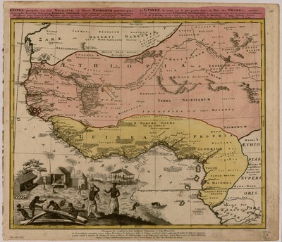
This historical map of Guinea and West Africa provides geographic context for understanding the regions connected to the transatlantic slave trade. It shows how European mapmakers represented African geography during the eighteenth century. The map is useful because it helps visitors identify the locations and regions connected to the history of the trade.
However, the map also reflects a European perspective. It emphasizes geographic locations, boundaries, and place names while leaving out many details about African communities, cultures, political systems, and everyday life. This matters because historical maps are not always neutral representations of the places they show. They can reflect the interests and knowledge of the people who created them.
By examining this map, visitors can consider how European geographic knowledge and commercial interests influenced the way Africa was represented. It also reminds us that African history existed beyond the information recorded by European mapmakers.
Keywords
Map, Transatlantic Slave Trade, European Map